- 12.2 km & 2100 vm
- 7 h
- Intermediate
MT. BAVŠKI GRINTAVEC HIKE
FROM VALLEY GREEN TO THE BEST VIEWS IN THE SOČA VALLEY
There are several routes to Bavški Grintavec from Bavšica and Zadnja Trenta, but this one from Soča is the easiest – though still challenging. It’s one of the less popular peaks, yet renowned for the best views in the Soča Valley. As one of the Julian Alps’ highest peaks, it demands significant fitness to conquer nearly 2000 meters of elevation gain.
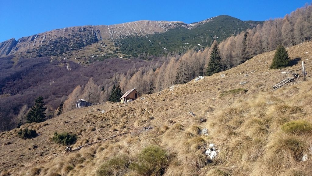
The trail begins with a steep climb, quickly leading to the scenic remnants of the abandoned high mountain hamlet, Lemovje. You’ll then traverse the sunny southern slopes, passing the hunting lodge on Planina nad Sočo – a natural balcony offering stunning, sweeping views across the Soča Valley and surrounding peaks.
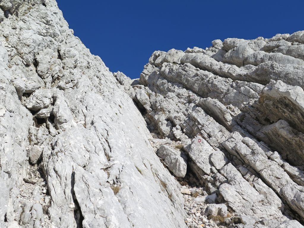
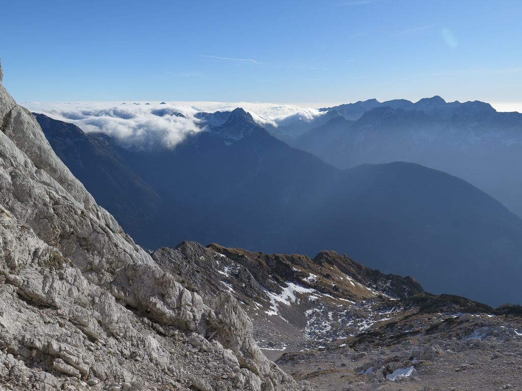
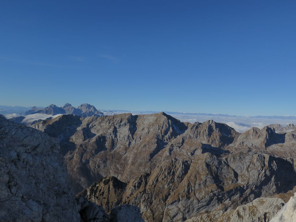
The path gradually leaves the dwarf pines and green meadows behind, transitioning into a rocky, gravelly landscape between Mali Grintavec and Kol. The final 50 meters to the elongated summit ridge requires a strenuous scramble over loose, eroded terrain, where the air is thin but rewards you with breathtaking 360° views.
STARTING POINT & PARKING
From Bovec, drive about 11 km to the center of the village of Soča. The marked trail begins approximately 200–300 meters from the church in the direction of Trenta. There is a small parking area nearby for 2 to 3 cars.
Route description: A step-by-step guide
- From the village of Soča, follow the trail marked Bavški Grintavec.
- The trail starts off fairly steep and after a good half hour leads you to the first alpine pasture, the site of the former village of Lemovje.
- The path crosses the meadow, turning left and then shortly back to the right, ascending into the forest.
- You then follow a gentle incline along the southern slopes below the peak of Kol (1924 m), eventually arriving at a hunting lodge on the pasture Planina nad Sočo.
- From the lodge, the route turns right and continues across mountain meadows, forest, and dwarf pines.
- Later, you’ll climb above the tree line into a valley between the peaks of Mali Grintavec and Kol, where the surface becomes rocky and gravelly.
- This terrain leads up to the final steep section, where the use of hands is required for a short scramble.
- From there, you proceed over a heavily eroded, loose surface to the summit.
- The descent follows the same path.
Extra tips
- Difficulty Note: While technically the easiest route to the summit, the continuous and significant elevation gain makes this a demanding, full-day tour.
- Safety: The upper part of the trail is heavily exposed to the sun and has loose, eroding rock. Especially during peak season when other hikers are present, wearing a helmet is strongly advisable due to the risk of falling rocks.
- Water: Carry plenty of water (at least 2.5–4 liters per person in summer), as there are no reliable water sources after the village of Soča.