Biking trip to Trnovo ob Soči

trip-trnovo_mezi_cezsocou_a_bokou_rombon

biking by the soča river

This circular biking route from Bovec to Trnovo ob Soči follows the beautiful Soča River along both banks, offering a mix of asphalt and gravel paths. Along the way, you’ll find numerous excellent spots for refreshing swimming.

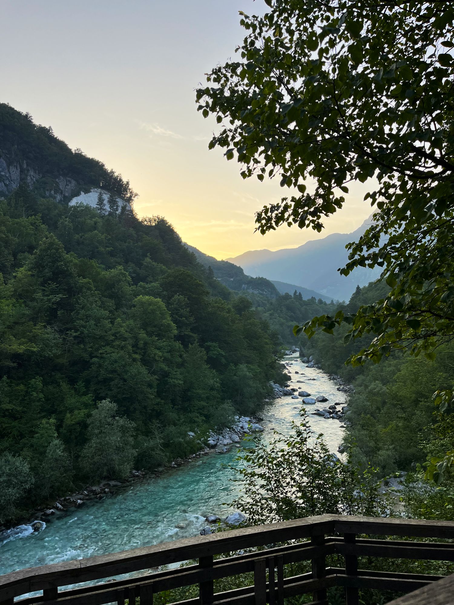
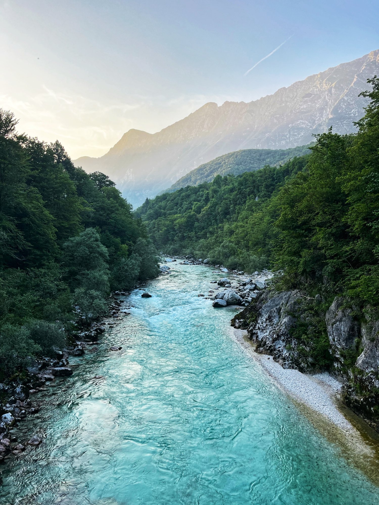
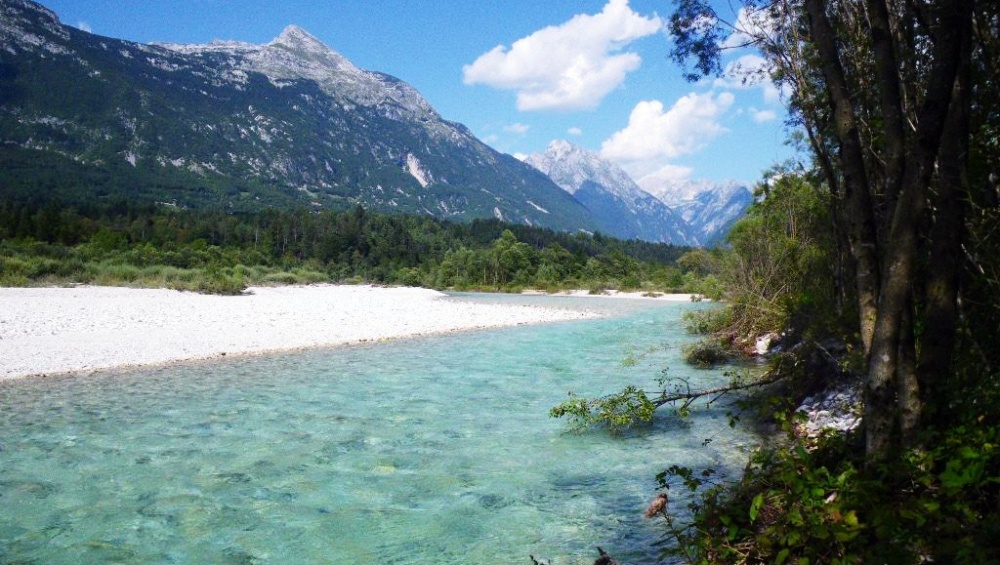
SCENIC CYCLING AND SWIMMING ALONG THE EMERALD SOČA

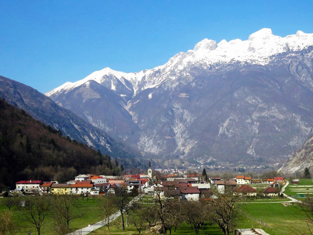
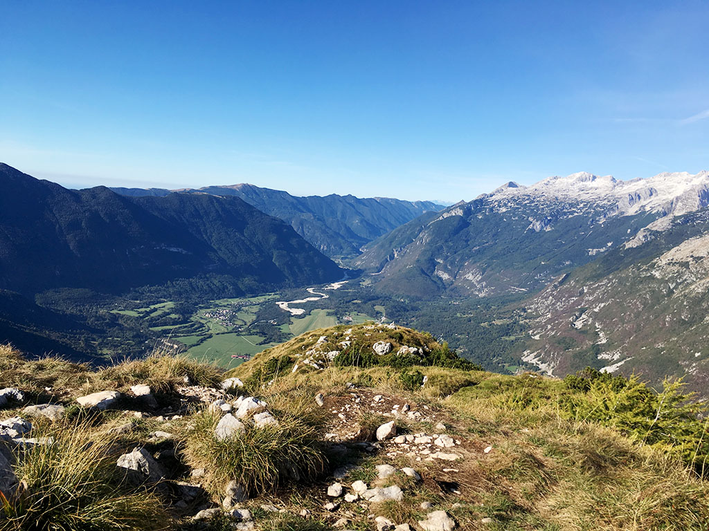
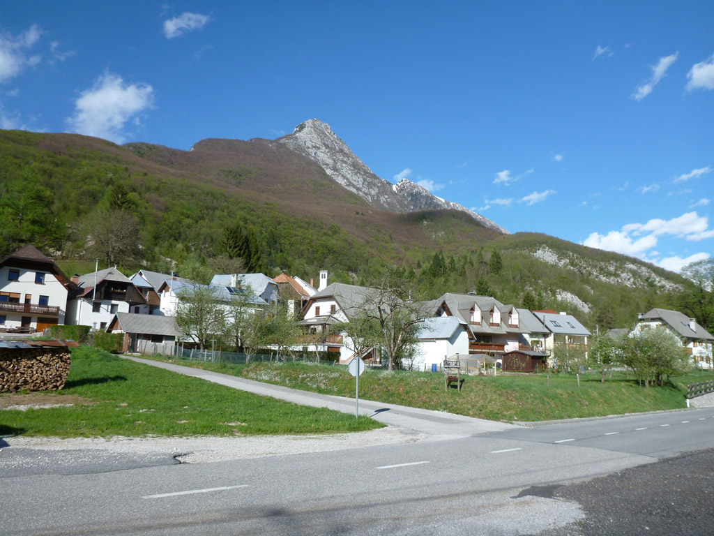
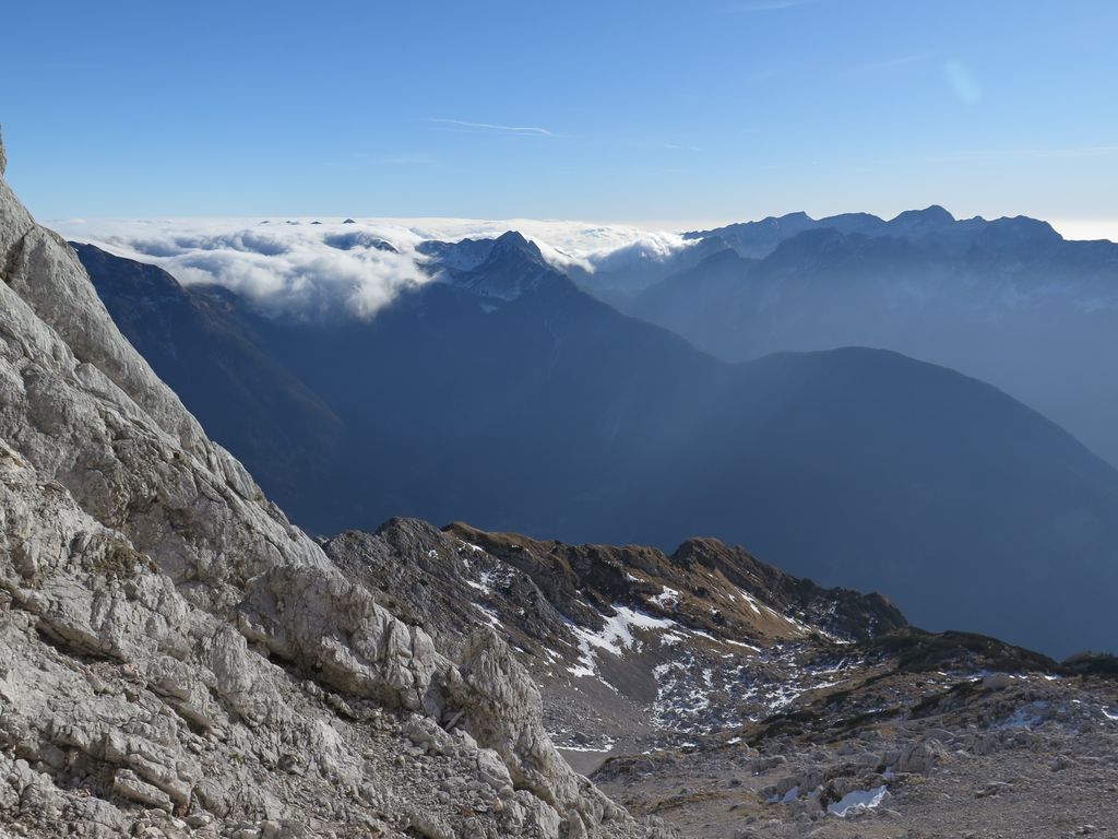
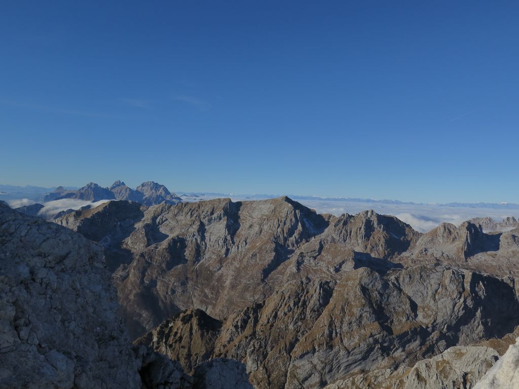
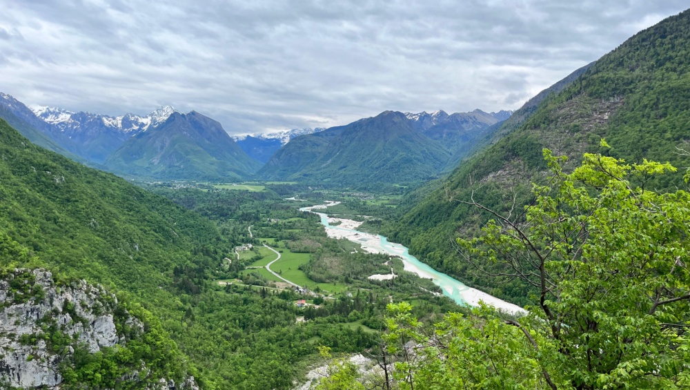
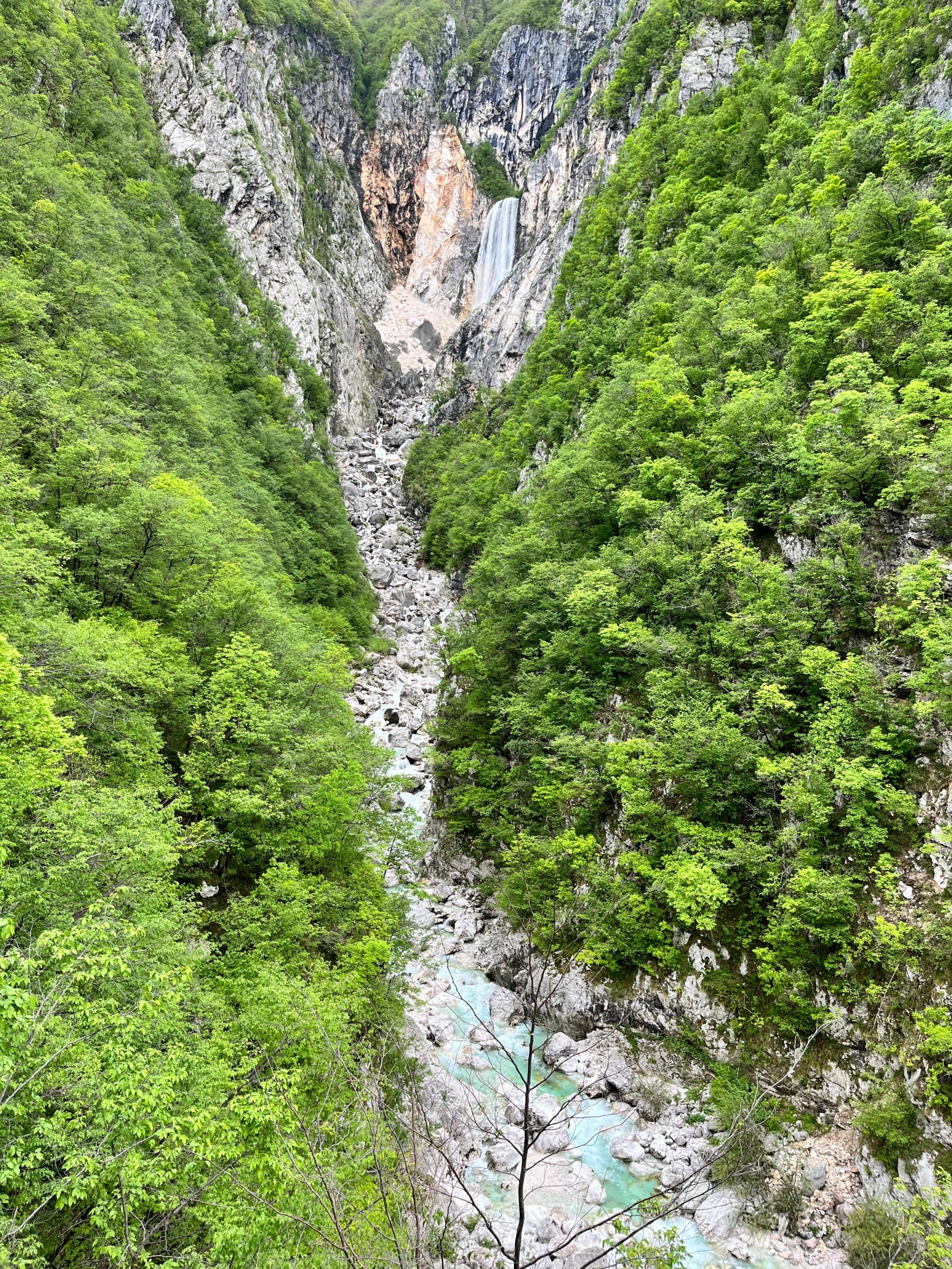
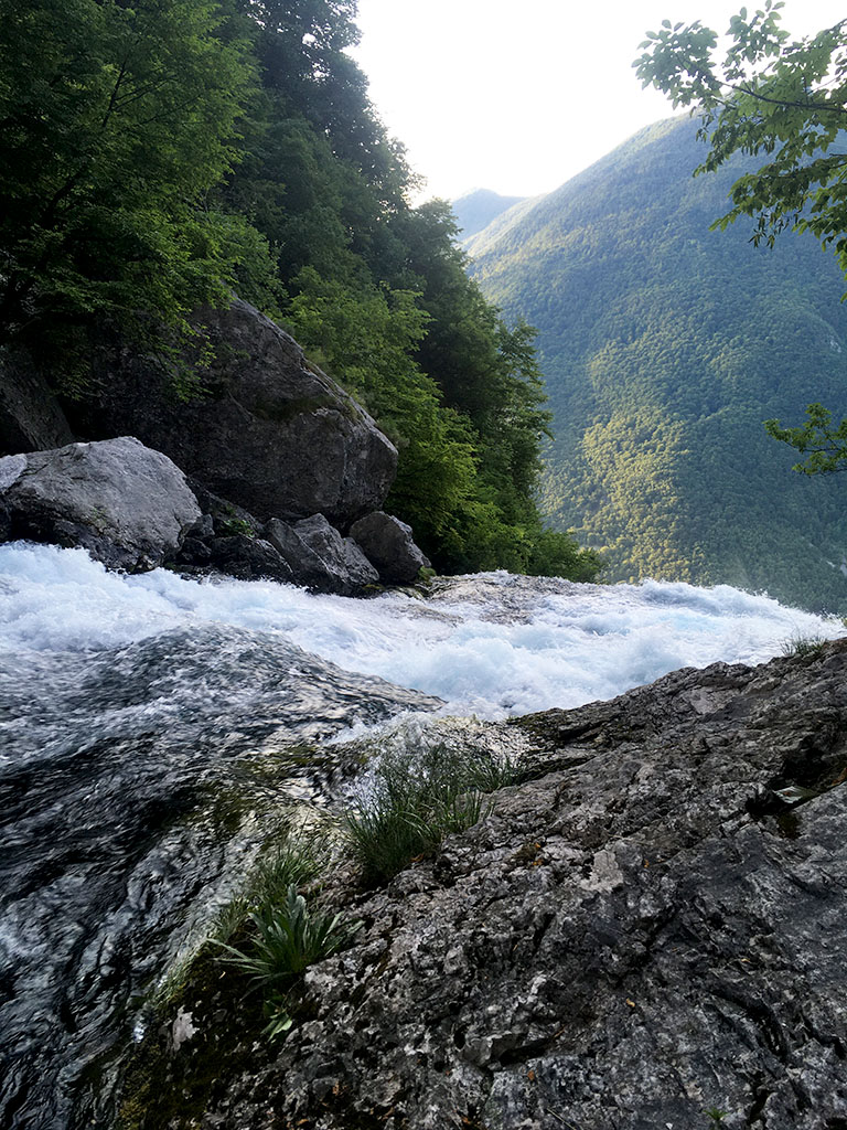
This popular biking route showcases the stunning Bovec basin and Soča River landscapes. You’ll initially enjoy views of the Kanin, Kanjavec and Triglav mountains and Boka waterfall, then spend most of your time riding alongside the emerald river. The elevated path offers perfect vantage points to watch kayakers and rafters navigating the waters below, while also providing spectacular views of the riverbeds and forests covering the Stol and Polovnik mountain slopes. With its pleasant, accessible terrain, multiple options to shorten your ride, inviting swimming spots, and peaceful meadows to rest on, this trail makes for nice half-day trip.

STARTING POINT & PARKING

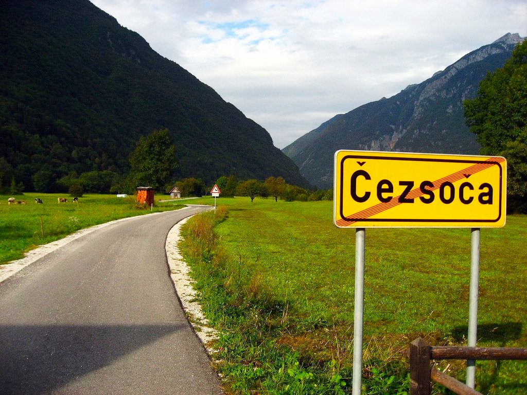
You can start the Biking to Trnovo ob Soči trip from anywhere in Bovec, including the Alpicenter Bovec or Vodenca campsites, this route description is based on a start from Čezsoča.

ROUTE DESCRIPTION: A STEP-BY-STEP GUIDE

  1.  Cross the bridge and pass through the village of Čezsoča. Continue on the asphalt road to the bridge near Boka waterfall. (Here you have your first option to return to the campsite via the road, shortening the trip to 13.7 km).
  2. To continue, follow the left bank of the Soča. In the village of Log Čezsoški, turn left and shortly after, turn right onto a dirt road.
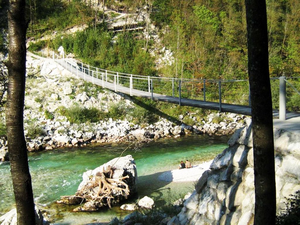
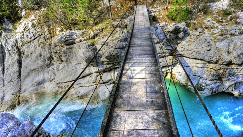
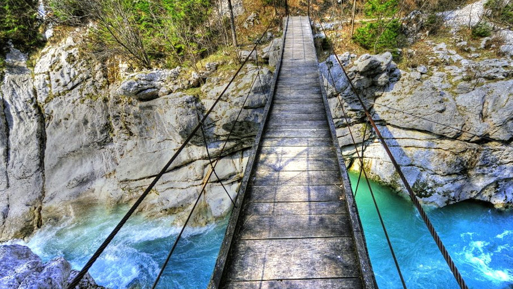
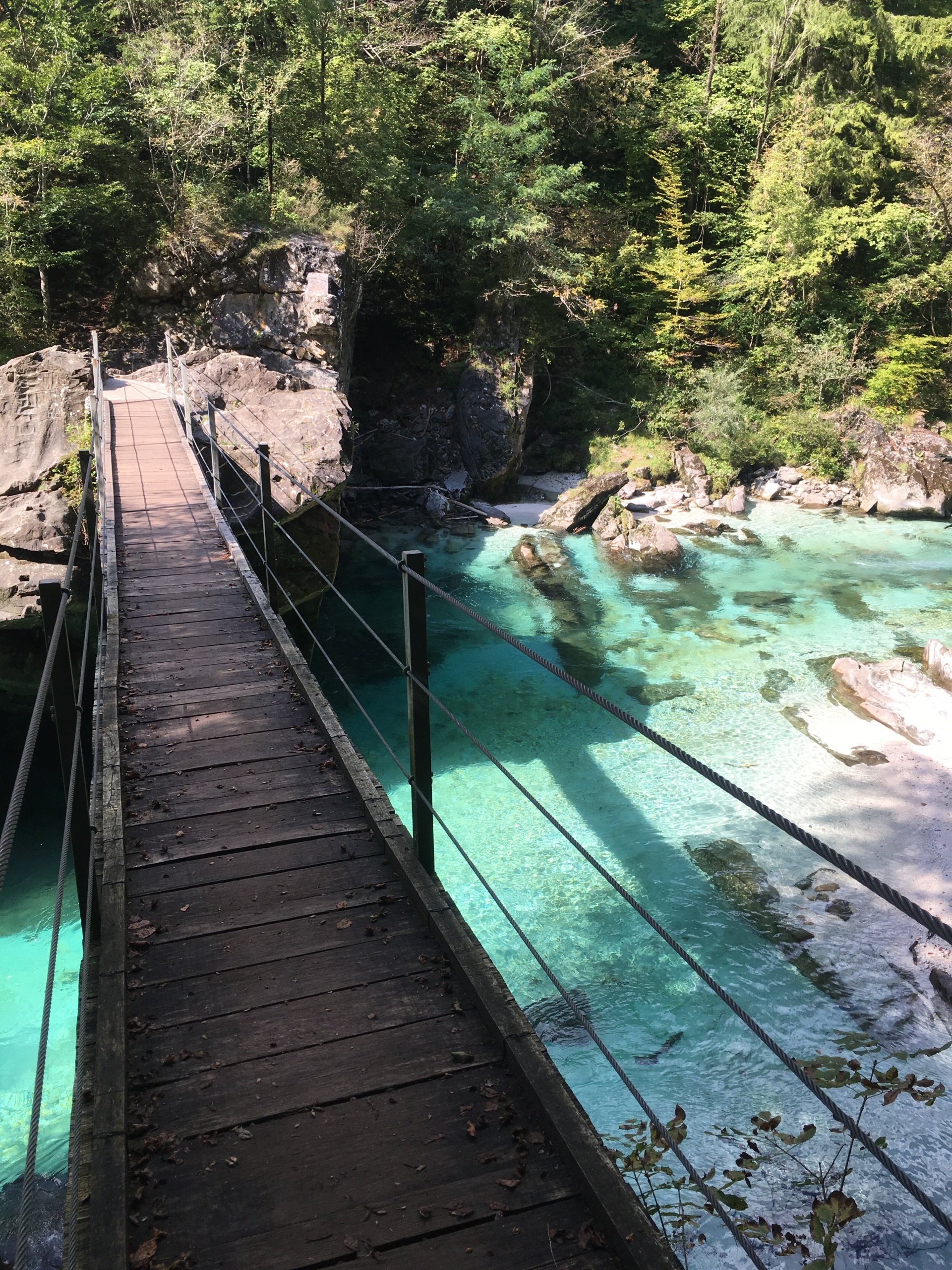
  3. After about two kilometers, you’ll reach a footbridge across the Soča. (This is your second option to cross early and return to Bovec, making the total trip just under 23 km).
  4. Otherwise, continue along the left bank. The trail becomes rockier here but remains easily rideable. The next bridge is in Trnovo ob Soči.
  5. Cross this bridge and follow the narrow asphalt road climbing through the fields to the main road.
  6. Turn right and follow the main road all the way back to Bovec.

Extra tips

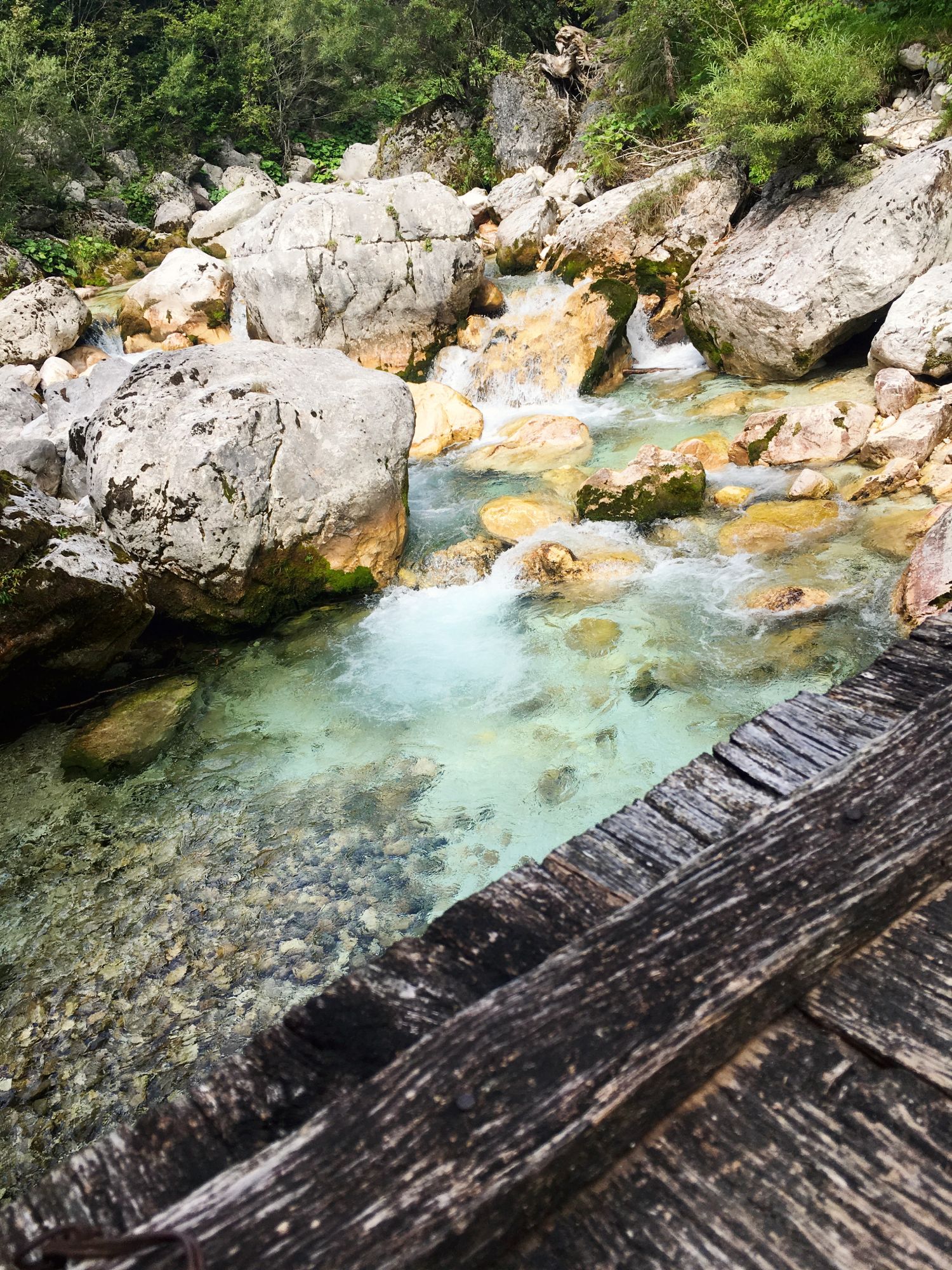
Bring swimming gear for hot summer days.
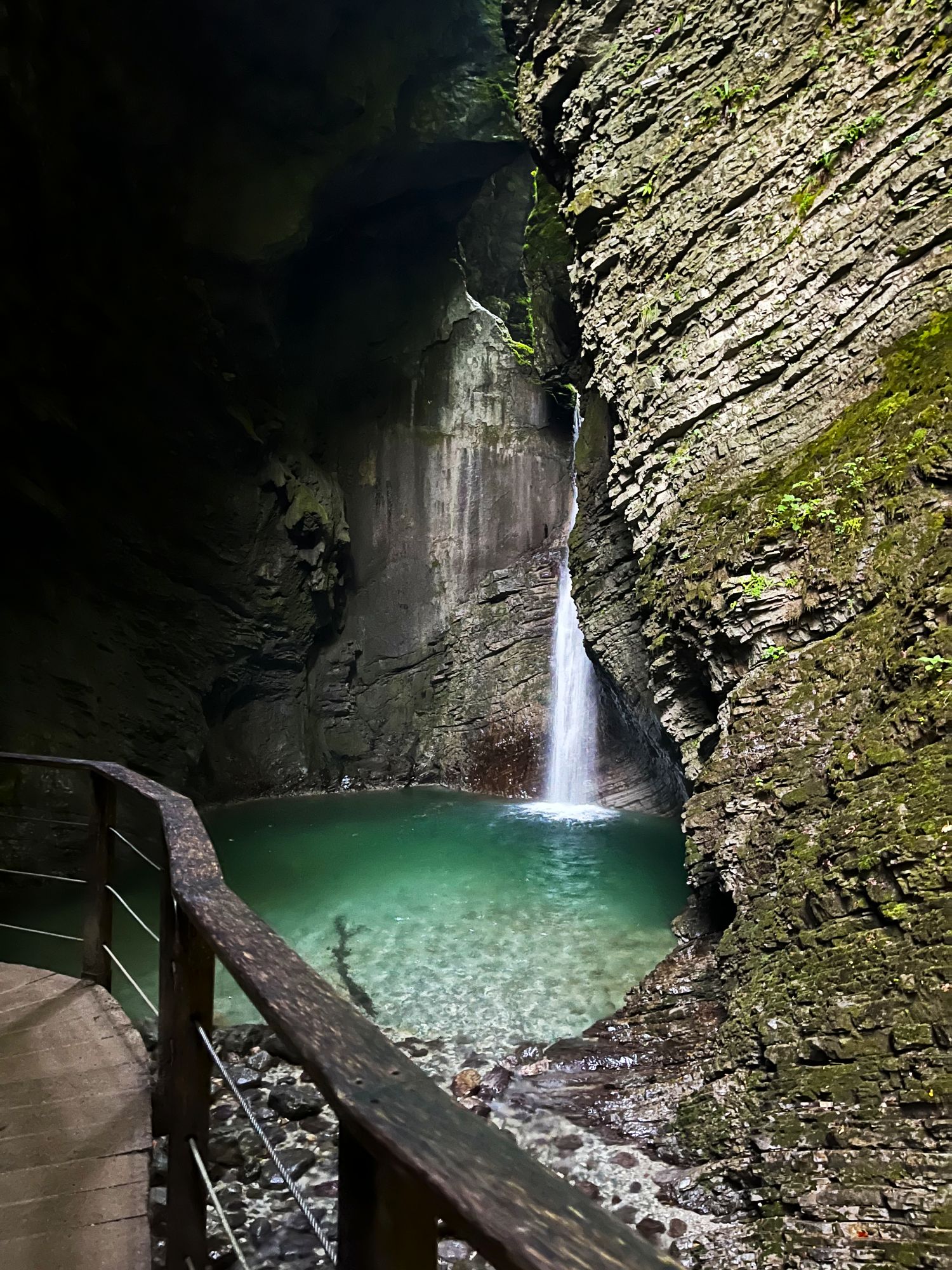
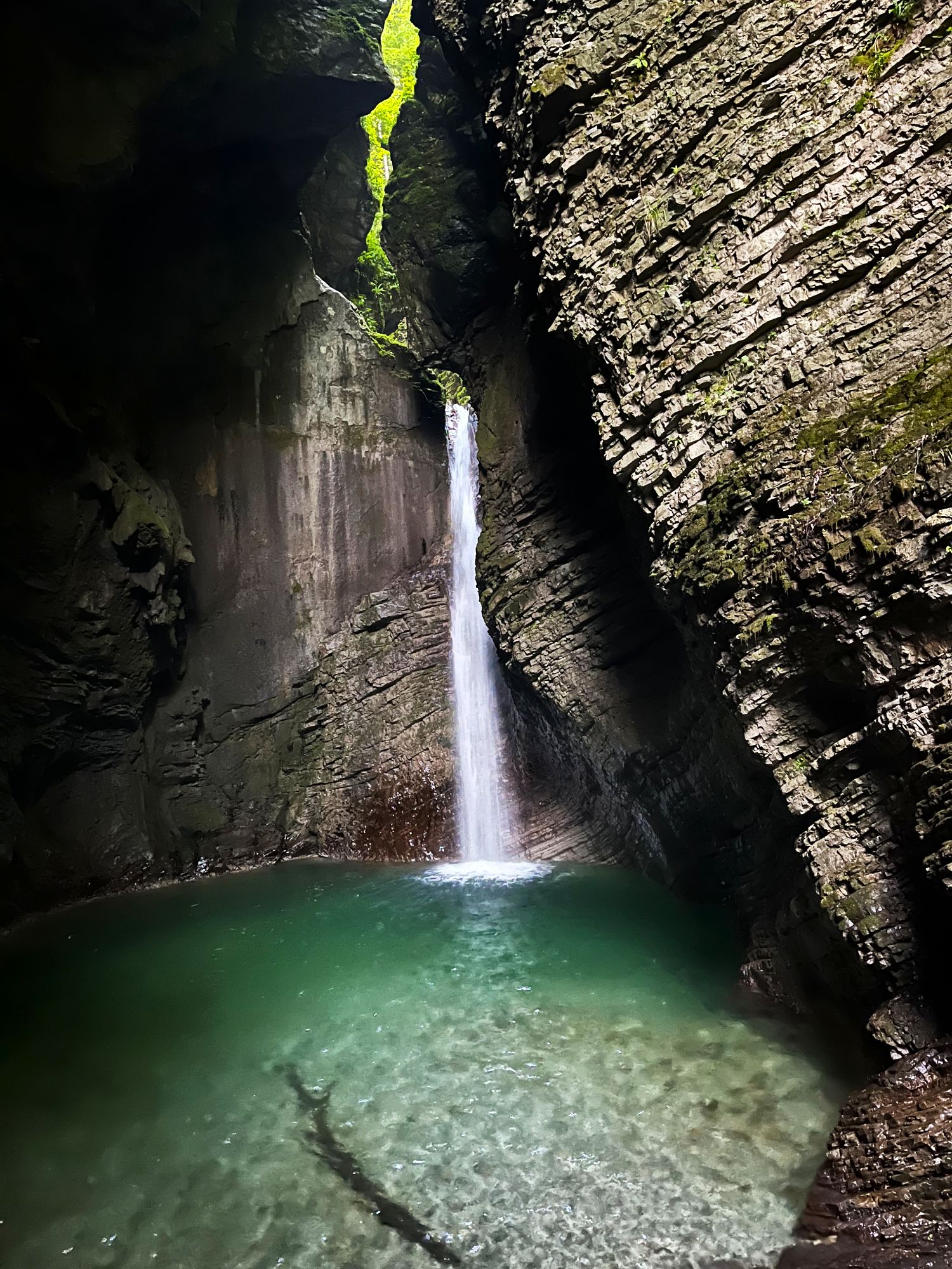
Easily accessible spots for a dip in the Soča river include the bridge near Boka waterfall, Trnovo, and the Srpenica rafting put-in point.
We recommend a mountain bike for this trip. A gravel bike is suitable for very skilled riders, due to loose gravel surfaces.

Kozjak waterfall walk

trip-kozjak_vodopad_pristup

KOZJAK waterfall walk

Leave the ordinary behind and step onto a walk that feels a world away. You’ll follow well-maintained trails, crossing the emerald Soča River and wander through beech forest to the stunning Kozjak Waterfall, tucked away beneath Mt. Krn near Kobarid.

THE MOST BEAUTIFUL SLOVENIAN WATERFALL WITH A MYSTERIOUS IMAGE IN THE WALL

More than just a strikingly beautiful sight, the Kozjak Waterfall carries a unique story. Its name comes from the Slovene word for goat shed, and you’ll discover why as you explore further. The trail leads you across swinging bridges and along the emerald Soča River, passing beneath the canopies of a dense beech forest. It feels a world away, yet it’s right at the foothills of Mt. Krn, ending with the magnificent **Kozjak Waterfall**—a 15-meter cascade that falls into a deep-green pool within an open chamber. Look closely at the wall to the left of the cascade to find the face of a “goatsman,” forever guarding this incredible place.

STARTING POINT & PARKING

From the town of Kobarid, turn left in the direction of Drežnica. Just before the Napoleon Bridge over the Soča, turn left again toward Camp Lazar. Look for a grassy parking area to the left of the road just before you reach the camp.

ROUTE DESCRIPTION: A STEP-BY-STEP GUIDE

  1. Z pa1. From the parking place, continue on foot straight along the road towards the camp. Follow the signs marked “Slap Kozjak.”
  2. After a short distance, you will see ruins of trenches and steps to your right. Take these steps down to a swaying footbridge that crosses the Soča River.
  3. After crossing the bridge, turn left. You will see many small WWI tunnels alongside the path.
  4. Continue on the trail, crossing a stone arch bridge from which you will get your first glimpse of a smaller waterfall.
  5. After the bridge, turn right along the creek upstream, and in a few hundred meters, you will be at the Kozjak Waterfall.

Extra tips

Entrance fee: is required to access the waterfall.
Bring your swimsuit! The walk offers plenty of opportunities to cool off in the refreshing Soča River along the trail.
On your way back, stop at the restaurant in Camp Lazar for a coffee or some delicious sweet or savory pancakes.

Mt. Svinjak hike – The Matterhorn of Bovec

trip-svinjak_vrchol

MT. SVINJAK HIKE – THE MATTERHORN OF BOVEC

Conquer this distinctive mountain, which dominates the Bovec basin due to its pyramid shape. Svinjak (1,653 m) is often called the “Bovec Matterhorn.” While technically manageable, the ascent is extremely steep and provides spectacular, well-earned views into the heart of the Julian Alps.

TRENUOUS CLIMB AND MONSTROUS VIEWS

Svinjak is not just a geographical marker; it’s renowned for offering the best views over Bovec and the entire Soča Valley, despite its relatively modest height. The name derives from Svitnjak (from ‘svit’ meaning “first morning light”), as the peak catches the rising sun’s rays when viewed from Bovec.

This rewarding hike demands 1,200 m of elevation gain over a short distance. Most of the trail winds through shaded forest—a welcome feature during summer heat. However, the final section traverses an open, steep, and exposed slope, with the path following a ridge high above the Soča and Koritnica river canyons.

At Svinjak’s summit, you’ll discover a miniature Aljaž Tower (the original stands on Mt. Triglav) and enjoy breathtaking 360° views—from the imposing Kanin and Rombon ranges to the Soča and Koritnica valleys and distant massifs toward Triglav. On your descent, consider visiting the nearby Čelo Open Air Museum featuring World War I remains.

STARTING POINT & PARKING

The Svinjak hike starts in the village of Kal Koritnica. Just before reaching the end of the village, you’ll find a small gravel parking lot on the right side of the road.

ROUTE DESCRIPTION: A STEP-BY-STEP GUIDE

  1. From the parking lot, cross the main road and continue straight between the houses.
  2. You’ll reach a gate where the footpath begins.
  3. When you arrive at the meadow on the saddle above the village, turn right where you’ll see signs for Svinjak.
  4. Pass the turn-off for Čelo and continue straight, carefully following the Svinjak markings.
  5. The path remains consistently steep and mostly runs through forest. In a few spots, you may need to use your hands for stability, but these short sections aren’t particularly difficult.
  6. The final section of the ascent emerges from the forest and follows a narrow path along a steep, exposed slope. Exercise extreme caution here, especially when the ground is wet, as a slip could be very dangerous.
  7. The path leads directly to the summit.
  8. Return along the same route.

Extra tips

  • The final segment of the trail is very steep, narrow, and covered with loose gravel, making it easy to slip. This hike is not recommended for people with severe vertigo or poor balance.
  • During summer, begin your hike very early in the morning to avoid intense heat and direct sunlight. Since there are no reliable water sources along the route, bring at least 2 liters of water per person.

Planina Golobar via Čez Utro saddle hike

trip-planina_golobar-5

Planina Golobar

This scenic hike leads through a beautiful beech forest to the Golobar alpine meadow via the Čez Utro saddle. Along the way, you’ll cross swinging bridges, visit a World War II memorial, and enjoy spectacular views of the Julian Alps.

WILDFLOWERS AND PATH OF PEACE

This hike to Planina Golobar is one of the Soča Valley’s hidden gems, combining natural beauty with historical significance. Meadow, which was originally used as a summer grazing ground, is now a high-mountain meadow dotted with seasonal wildflowers and home to a memorial made of rifles honoring 42 Partisan soldiers who fell during World War II.

The trail winds through a shaded beech forest and follows old military routes along the Pot Miru (Walk of Peace) trail. This path provides cool shade during summer hikes to Golobar Pasture and the Čez Utro saddle, which sits between the peaks of Javoršček and Hudi Vrh. From this vantage point, you are rewarded with fantastic, wide-open views across the Western Julian Alps.

With a 960 m elevation gain, this technically easy route offers a peaceful full-day experience away from the tourist crowds.

Starting point & parking

The Planina Golobar via Čez Utro saddle hike starts just south of Bovec in the small village of Kal Koritnica. When you reach the village, continue through it until just before the end, where you’ll find a small gravel parking lot on the right side of the road.

ROUTE DESCRIPTION: A STEP-BY-STEP GUIDE

  1. From the parking lot, walk along the dirt track that parallels the main road.
  2. The track soon swings right toward a supply cableway (a steel cable).
  3. At the cableway, take the road left downhill, and after a few meters, turn right onto the marked footpath.
  4. Follow this footpath to the footbridge across the Soča River, then follow the signage for Planina Zaprikraj, Planina Golobar, and the Pot Miru (Path of Peace).
  5. At the start of the climb, you’ll briefly cross the gravel road a few times, but always return quickly to the footpath.
  6. Continue ascending steadily on the footpath through the forest until you reach the Planina Golobar meadow. In the upper-left part of the meadow, locate the cross/memorial made of rifles.
  7. From the meadow, continue a short distance to the Čez Utro Saddle, where you’ll enjoy panoramic views.
  8. Return along the same route. Be careful on the steep sections during your descent.

Extra tips

While technically easy, the nearly 1000 m of elevation gain makes this a full-day hike. Ensure you have adequate water and snacks.

The trail follows clear red and white markings, occasionally reinforced by signs for Pot Miru.

Mt. Mangart Climb – Ferrata Via Slovenia

trip-ferrata_via_slovenie-4

MT. MANGART CLIMB FERRATA VIA SLOVENIA POT

Climb the majestic Mt. Mangart (2679 m) via its western face on the challenging and adventurous Ferrata Via Slovenia (Slovenska pot). This popular route offers a rugged, high-alpine experience with spectacular views across the Western Julian Alps.

WEST FACE ROUTE WITH VIEWS ACROSS THE WESTERN JULIAN ALPS

Unlike the consistently protected Via Italiana, the Slovenian Route (Slovenska pot) features exposed stretches with minimal protection. This route is usually climbed as a loop, ascending Via Slovenia and descending via Italijanska pot back to Mangart Saddle.

The route begins from Mangart Saddle, turning right onto Slovenska pot. It alternates between well-secured sections (fixed cables, rungs) and unprotected alpine scrambling across loose scree, demanding excellent concentration and sure footing throughout.

The reward is magnificent: breathtaking views of the mountains above the Soča Valley and Italian Montasio (second highest peak in Julian Alps after Triglav). The ferrata eventually reaches the summit at 2679 m. With 626 m of elevation gain, this route requires good fitness and high confidence on loose terrain.

STARTING POINT & PARKING

The trip starts at the end of Slovenia’s highest road, the Mangart Road.

  1. Driving: From Bovec, drive towards the Predel border crossing. Just after the village of Strmec, turn right onto the marked road for Mangrtsko Sedlo (Mangart Saddle).
  2. Toll: You will pass a toll gate (approx. €10 per car for the ecological tax).
  3. Parking: Follow the narrow, winding road to the highest possible point, above the Mangart Hut, where you’ll find a one-way loop at Mangart Saddle (∼2055 m). Park legally in the designated areas.

ROUTE DESCRIPTION: A STEP-BY-STEP GUIDE

  1. From the parking area, follow the main footpath towards Mangart.
  2. At the signed junction near Mali Mangart, turn right onto the path marked Via Slovenia (Slovenska smer).
  3. The path leads you beneath the mountain’s west face to the entrance of Slovenska pot, where the via ferrata climb begins.
  4. The route alternates between secured cable sections and long, exposed stretches over loose scree, dirt, and rock. Maintain focus and follow the mountain markings (red circles, paint) in the unprotected sections. Caution: This area suffers from severe erosion and loose rock.
  5. The ferrata section ends at the scree. Follow the marked hiking path to the left for the final ascent to the summit of Mt. Mangart (2679 m), just a few steps away.
  6. Do not descend the summit via the Ferrata Via Slovenia. Its loose rock and lack of continuous protection make it unsafe for descent. Instead, take the normal route to the right (Italijanska pot), which is technically less demanding and serves as the safest and most commonly used return route, leading directly back to the Mangart Saddle parking lot and completing the loop.

Extra tips

  • The Via Slovenia is a demanding high-alpine route. Its C rating is largely due to the exposure and the highly dangerous unprotected sections over loose, crumbly rock and scree. It is only suitable for experienced mountaineers with a high tolerance for exposure and a good head for loose terrain.
  • Be extremely careful of falling rocks, both from above and those you may dislodge.
  • Do not attempt in storms, heavy rain, or when there is ice or snow on the route.
  • Proper via ferrata equipment and safe handling techniques are essential for your safety on this route.

Mt. Bavški Grintavec – 2 347 m

trip-bavski_grintavec-9

MT. BAVŠKI GRINTAVEC HIKE

A stunning panoramic hike from the village of Soča in Trenta Valley. This easiest route to the 2,347 m summit guides you through diverse mountain terrain and past the abandoned village of Lemovje.

FROM VALLEY GREEN TO THE BEST VIEWS IN THE SOČA VALLEY

There are several routes to Bavški Grintavec from Bavšica and Zadnja Trenta, but this one from Soča is the easiest – though still challenging. It’s one of the less popular peaks, yet renowned for the best views in the Soča Valley. As one of the Julian Alps’ highest peaks, it demands significant fitness to conquer nearly 2000 meters of elevation gain.

The trail begins with a steep climb, quickly leading to the scenic remnants of the abandoned high mountain hamlet, Lemovje. You’ll then traverse the sunny southern slopes, passing the hunting lodge on Planina nad Sočo – a natural balcony offering stunning, sweeping views across the Soča Valley and surrounding peaks.

The path gradually leaves the dwarf pines and green meadows behind, transitioning into a rocky, gravelly landscape between Mali Grintavec and Kol. The final 50 meters to the elongated summit ridge requires a strenuous scramble over loose, eroded terrain, where the air is thin but rewards you with breathtaking 360° views.

STARTING POINT & PARKING

From Bovec, drive about 11 km to the center of the village of Soča. The marked trail begins approximately 200–300 meters from the church in the direction of Trenta. There is a small parking area nearby for 2 to 3 cars.

Route description: A step-by-step guide

  1. From the village of Soča, follow the trail marked Bavški Grintavec.
  2. The trail starts off fairly steep and after a good half hour leads you to the first alpine pasture, the site of the former village of Lemovje.
  3. The path crosses the meadow, turning left and then shortly back to the right, ascending into the forest.
  4. You then follow a gentle incline along the southern slopes below the peak of Kol (1924 m), eventually arriving at a hunting lodge on the pasture Planina nad Sočo.
  5. From the lodge, the route turns right and continues across mountain meadows, forest, and dwarf pines.
  6. Later, you’ll climb above the tree line into a valley between the peaks of Mali Grintavec and Kol, where the surface becomes rocky and gravelly.
  7. This terrain leads up to the final steep section, where the use of hands is required for a short scramble.
  8. From there, you proceed over a heavily eroded, loose surface to the summit.
  9. The descent follows the same path.

Extra tips

  • Difficulty Note: While technically the easiest route to the summit, the continuous and significant elevation gain makes this a demanding, full-day tour.
  • Safety: The upper part of the trail is heavily exposed to the sun and has loose, eroding rock. Especially during peak season when other hikers are present, wearing a helmet is strongly advisable due to the risk of falling rocks.
  • Water: Carry plenty of water (at least 2.5–4 liters per person in summer), as there are no reliable water sources after the village of Soča.

Soča river swinging bridges walk

trip-lavky_pres_socu-2

SOČA RIVER SWINGING BRIDGES WALK

Leave the ordinary behind and take a relaxing walk along the emerald waters of the Soča and Koritnica rivers. This circular trail follows well-maintained paths through forests and canyons, offering unique views of the surrounding mountains from several picturesque swinging bridges.

A WALK ALONG THE EMERALD THREAD

This popular and relaxing circular walk from Bovec offers a perfect way to experience the natural beauty of the Soča and Koritnica river valleys. The trail guides you through dense forests, allowing you to cross between riverbanks via wooden suspension bridges. These bridges hang just above karst canyons and boulder-garden-like riverbeds, with the green Koritnica and turquoise Soča rivers flowing beneath. Along the way, you’ll enjoy glimpses of the towering Julian Alps and their foothills in the background. Beyond the photogenic swinging bridges, the trail’s highlights include beautiful meadows and the opportunity to step into the Triglav National Park.

STARTING POINT & PARKING

While this circular trail can be started from anywhere in Bovec, the most common starting points are Alpi Center Camps Bovec and Vodenca. This route description begins from Camp Polovnik in Bovec.

ROUTE DESCRIPTION: A STEP-BY-STEP GUIDE

  1. From Camp Polovnik, follow the gravel road past the church Cerkev Device Marije v Polju. Cross the main road and continue along the field path on the opposite side.
  2. The path soon veers left, passing a small ski lift and crossing over a small hill. After descending the hill, you’ll reach an asphalt road.
  3. Turn left onto the asphalt road and walk downhill past Camp Alpicenter Vodenca. Just before reaching the camp, turn left onto a marked forest path.
  4. Walk through the lower campsites and past the restaurant at Camp Liza to reach the trail leading to the footbridge over the Koritnica River.
  5. After crossing the footbridge, turn right to walk along the confluence of the Soča and Koritnica rivers. Then cross the first available footbridge over the Soča.
  6. Once across the Soča, turn left onto the asphalt path, which soon ends and becomes a trail leading to the Golobar Gorge.
  7. After exploring the gorge, backtrack slightly and cross the Soča on a footbridge located a bit further downstream. On the right bank, this bridge is anchored to a black rock—a popular spot for jumping into the water.
  8. Continue on the trail along the right bank of the Soča and cross the next footbridge you encounter.
  9. The trail now follows an asphalt section before turning right onto a gravel road (opposite the swimming pool).
  10. When you reach the village of Čezsoča, cross the main road bridge and turn left onto the gravel path that climbs toward the airfield.
  11. Walk around the airfield, keeping it on your right side. From here, it’s a short walk back to your starting point in Bovec.

Extra tips

The black rock supporting the bridge is a popular spot for locals to enjoy a refreshing – though chilly – plunge into the river on hot days.

When approaching the confluence of the two rivers, pause to admire how their waters merge. During rainy periods, one river may flow brown and silty while the other maintains its clear emerald-green color, creating a dramatic visual contrast.

Source of Boka waterfall hike

trip-boka

SOURCE OF BOKA WATERFALL HIKE

A steep, increasingly technical ascent to the spring above the 106-meter Boka Waterfall. The final descent to the source is wild, exposed, and unsecured.

THE CHALLENGE TO THE KARST SPRING IN THE KANIN MOUNTAINS

This demanding and rewarding hike takes you to the powerful karst spring that feeds Slovenia’s most magnificent waterfall. The trail offers an exciting, sporty and jaw dropping journey. It starts with a steep ascent and becomes increasingly technical as you climb towards the source, which is located in the Kanin mountain wall at an altitude of 725 meters. As you approach the large plateau, you’ll witness Boka emerge directly from the rocky ground—a truly raw and impressive display of nature’s power. From here, you’ll get a rare view of the Soča River as it runs around the Polovnik ridge—a view accessible only to those who can make the challenging hike.

STARTING POINT & PARKING

The hike begins from the main road between Bovec and Žaga. You can park at the gravel parking area near the bridge over the Boka River or at the asphalt parking lot next to Hotel Boka.

ROUTE DESCRIPTION: A STEP-BY-STEP GUIDE

  1. From the bridge over the Boka creek, look upstream at the waterfall. The marked hiking trail to the source begins on the right side of the bridge.
  2. The initial part of the path is mostly flat, but after a few hundred meters, you will begin a relentless, steep climb.
  3. As you ascend, you will come across several improvised viewpoints that offer different perspectives of the waterfall.
  4. Towards the final section of the climb, the path becomes more technical and exposed. Here, you will encounter fixed steel safety cables to assist you on the steep rock faces.
  5. After the roped section, you will face a short but very steep and unsecured descent to the spring just above the waterfall.

Extra tips

This is an expert-level route. The final descent to the spring is wild, unsecured, and can be extremely slippery. Do not attempt this hike without a good physical condition, experience in difficult mountain terrain, and solid footwear with good grip.

Mt. Mangart Climb Ferrata Via Italiana

trip-ferrata_via_italiana-8

MT. MANGART CLIMB FERRATA VIA ITALIANA

Ascend the majestic Mt. Mangart (2679 m) via the airy and well-secured Ferrata Via Italiana. This classic high-alpine route traverses the exposed north face, offering spectacular views into Italy with the turquoise Laghi di Fusine (Fusine Lakes) below. It’s an essential climb for anyone seeking an authentic Julian Alps ferrata experience.

NORTH FACE ROUTE WITH SPECTACULAR VIEWS OF THE FUSINE LAKES

The Ferrata via Italiana is one of the two famous secured climbing routes (besides ferrata via Slovenska pot) to the summit of Mangart. Rated a challenging C/D, it is the more technical and continuously protected route of the two.

The trip begins with a short but steep descent from the high Mangart Saddle (Mangartsko sedlo) down into the Italian side, leading to the base of the mountain’s north wall near the Bivacco Nogara. From here, the route climbs relentlessly, featuring long, vertical sections and exposed traverses, all brilliantly secured with handrails, numerous iron rungs and staples.

The trail offers continuously spectacular views down the steep wall to the glacial lakes of Laghi di Fusine, with the Italian and Austrian Alps stretching across the horizon. The ferrata ultimately connects with the Italian path, allowing you to reach the summit at 2679 m. The total elevation gain is significant, requiring good fitness and experience in exposed terrain.

STARTING POINT & PARKING

The trip starts at the end of Slovenia’s highest road, the Mangart Road.

  1. Driving: From Bovec, drive towards the Predel border crossing. Just after the village of Strmec, turn right onto the marked road for Mangrtsko Sedlo (Mangart Saddle).
  2. Toll: You will pass a toll gate (approx. €5 per car).
  3. Parking: Follow the narrow, winding road to the highest possible point, a one-way loop just below the Mangart Saddle (∼2055 m). Park legally here.

ROUTE DESCRIPTION: A STEP-BY-STEP GUIDE

  1. From the parking area, follow the main footpath towards Mangart. You will soon see a saddle/ridge on your left.
  2. At the signed junction, turn left towards Via Italiana, Bivacco Nogara, and Laghi di Fusine. Follow the steep trail downhill into the Italian side of the mountain. You will lose about 200 m of elevation here.
  3. Continue following the path past a small pass (often opening up views to the Italian side). The trail leads down towards the Bivacco Nogara.
  4. Just before or at the bivouac, follow the signs and cairns leading slightly uphill back toward the massive north wall to the start of the secured route.
  5. Clip in and begin the climb. The route is well-protected and features numerous vertical sections and ladders. Maintain focus due to the height and exposure.
  6. The ferrata section ends high on the mountain, near a junction on the scree slope.
  7. At this junction, you can either continue to the summit or return to the Mangart saddle. To reach the summit, follow the marked hiking path (non-ferrata section) to the left, which leads to the top of Mt. Mangart (2679 m). For the descent, take the normal trail to the right (Italijanska pot), which leads directly back to the Mangart Saddle parking lot. This is the safest and most commonly used return route.
  8. If you reach the summit, return by the same path to where you joined the hiking trail, then descend directly via the normal trail (Italijanska pot) back to the Mangart Saddle.

Extra tips

The Via Ferrata Italiana is a challenging (C/D) and highly exposed route suitable only for mountaineers with prior via ferrata experience and a good head for heights. The initial descent to the wall is steep and can be slippery. Do not attempt in storms, rain, ice, or snow.

Proper via ferrata equipment and safe handling techniques are essential for your safety on this route.

Čelo – WWI Historic Site

trip-celo-9

ČELO HIKE – WWI HISTORIC SITE

Take a hike to the open-air museum at Čelo on the hillside of Mt. Svinjak. This family-friendly trail leads you to the remains of a historic WWI gun fort, offering incredible views of the Bovec basin and the stunning Soča and Koritnica River Valleys.

A WALK THROUGH HISTORY: ČELO OPEN-AIR MUSEUM

This unique and rewarding hiking trip takes you to Čelo, an open-air museum nestled on the slopes of Mt. Svinjak. Known as “Stützpunkt Kal” by the Austro-Hungarian army, the site served as a key fortification for defending the Bovec basin during World War I. The trail leads to a well-preserved, 200-meter-long trench system, complete with two gun positions, a kitchen, a watchtower, and a shelter. From this strategic position, you’re rewarded with sweeping views. Below the mountains lies the village of Bovec, and before you are the lush, green valleys of the Koritnica and Soča rivers. This easy hike offers a powerful blend of historical insight and natural beauty and is part of the Walk of Peace, accessible from the village of Kal-Koritnica.

STARTING POINT & PARKING

To begin your hike to the Čelo open-air museum, drive to the small village of Kal-Koritnica. Look for a small gravel parking area on your right just before the end of the village. This is the designated spot to park your car and start your walk.

ROUTE DESCRIPTION: A STEP-BY-STEP GUIDE

  1. From the gravel parking area, cross the main road and walk straight between the houses, following the signposts that point toward Mt. Svinjak and Čelo.
  2. You will soon reach a gate, which marks the official start of the trail.
  3. Continue uphill until you reach a meadow at the saddle above the village. Here, turn right, following the signs toward Mount Svinjak.
  4. After approximately 500 meters, you will see a signpost for Čelo. Leave the main trail and turn left here. The Čelo historic site is less than 200 meters away.

Extra tips

  • Take your time to explore the historic trenches and soak in the incredible views.
  • If you want a longer challenge, you can continue your hike toward the summit of Mount Svinjak. Otherwise, simply follow the same path back to your car.

The Ravelnik – open-air museum

trip-ravelnik-5

RAVELNIK OPEN-AIR MUSEUM WALK

Easy walk to a free open-air museum Ravelnik. Grab a headlamp and explore also underground places and caves.

A WALK THROUGH HISTORY: RAVELNIK OPEN-AIR MUSEUM

This easy and rewarding walk takes you directly into the network of trenches and bunkers from World War I. The Ravelnik hill was a key Austro-Hungarian defensive line, built to protect the strategic road into the Bovec basin. The trail guides you through a large outdoor museum atop of the right bank of the Koritnica River, where you can explore original shooting trenches, caverns, bunkers, and renovated barracks. At the very top of the hill, you can even see the crater from the only grenade that struck the position during the war.

STARTING POINT & PARKING

This hike starts right from Bovec, so no driving is required. The route description is based on a departure from Camp Polovnik, but the trail is also easily accessible from Alpi Center Camp in Vodenca and other locations within the town.

ROUTE DESCRIPTION: A STEP-BY-STEP GUIDE

  1. From Camp Polovnik, follow the gravel path past the Cerkev Device Marije v Polju church until you reach the main road.
  2. Cross the road and continue on the field path on the other side.
  3. After a short while, the path will keep left and pass under a small ski lift, then begin to climb a small hill.
  4. Before the path descends again, take a left turn onto a smaller footpath and follow the “Pot miru” (Walk of Peace) and “Muzej na Prostem Ravelnik” (Ravelnik Open-Air Museum) signs.
  5. You will soon pass the top of Ravelnik hill and quickly reach the first trenches and shelters. Here, you can spend as much time as you like exploring the numerous underground caverns.

Extra tips

  • Bring a headlamp! Many of the underground passages and caverns on Ravelnik are extensive and require a light source to explore safely.

Soča River spring hike

vylet-pramen_soci_1

Soča river spring hike

A short, scenic mountain path leads you through picturesque surroundings to the very beginning of the iconic Soča River, known as one of the purest and most beautiful rivers in the world.

IZVIR SOČE – THE SOURCE OF THE EMERALD RIVER

This short and rewarding hike leads you directly to the source of the legendary Soča River. The trail itself is a beautiful experience, a breathtaking sight of the river’s spring – the start of its 138 km long journey to the Adriatic Sea. You’ll witness it gushing from a narrow, rocky cave, often turning into a spectacular waterfall arena during high flows—a powerful revelation of this emerald-green masterpiece’s origin.

STARTING POINT & PARKING

To begin your hike, drive from Bovec toward Trenta, Vršič, and Kranjska Gora. After about 24 km of driving through the Upper Soča Valley, you will see a sign for Izvir Soče and a left turn on a sharp right-hand hairpin bend. Drive for another kilometer and park at the hut named Koča pri Izviru Soče.

ROUTE DESCRIPTION: A STEP-BY-STEP GUIDE

  1. From the parking lot, walk past the hut and begin heading slightly uphill on the path. The trail follows the stream (the young Soča River).
  2. The path branches in several places, but the various routes always rejoin. Stay on the most used path as you make your way towards the spring.
  3. In the final, more challenging section, you will encounter a steel cable railing. Be sure to hold on and use the cable to help you navigate this steeper part of the trail.
  4. Once you reach the spring, you can explore the area. During times of low water, you may even be able to walk into the riverbed.
  5. To return, simply follow the same path back to the parking lot.

Extra tips

Be aware that the final section of the trail is steep and can be slippery, especially after rain. Wear sturdy footwear.
Given its beauty and accessibility, this site can get very busy during peak summer season. For a more peaceful experience plan to visit early in the morning or late in the afternoon.